
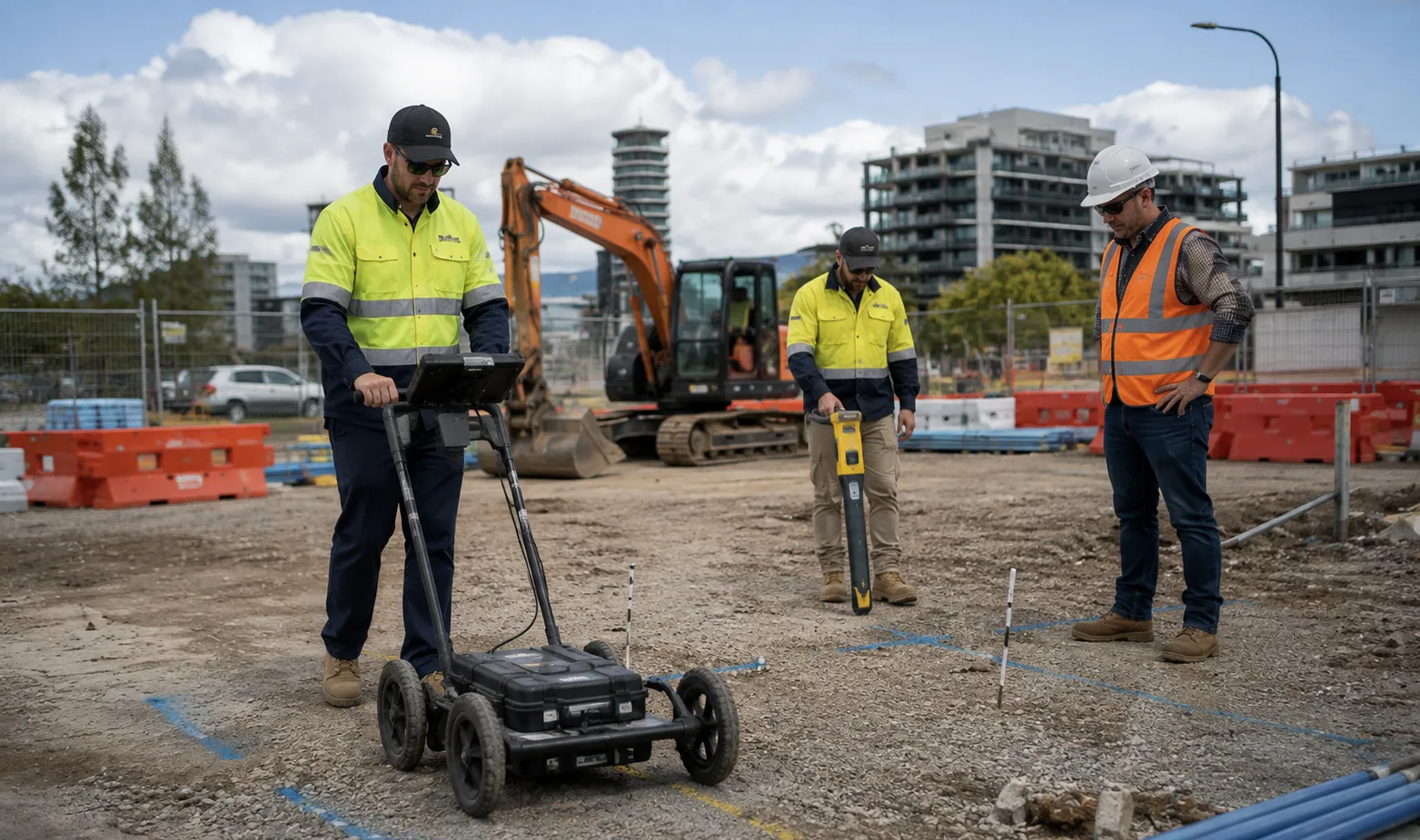
Avoiding Costly Project Delays: The Role of Utility Mapping in Modern Construction
Read Time:3 Minute, 34 Second
Every successful construction project begins with proper planning. While site surveys, permits, and engineering designs often receive significant attention, one critical step is frequently underestimated-understanding what lies beneath the ground. Hidden utilities such as water mains, gas pipelines, electrical cables, telecommunications networks, and sewer systems can create serious challenges if they are not accurately identified before excavation begins.
Unexpected utility strikes can cause costly delays, damage critical infrastructure, create safety hazards, and result in substantial repair expenses. This is why more contractors, developers, and project managers are investing in professional utility mapping services before breaking ground.
Why Underground Assets Create Major Project Risks
Modern cities and industrial areas contain complex networks of underground infrastructure built over decades. In many cases, utility records may be outdated, incomplete, or inaccurate. Relying solely on historical plans can expose projects to significant risks.
When underground services are not correctly identified, excavation crews may accidentally damage essential assets. A single strike on a gas line or electrical cable can halt an entire project, trigger emergency responses, and place workers at risk.
Professional utility mapping helps project teams gain a clear understanding of underground conditions before excavation begins, reducing uncertainty and improving decision-making.
The Hidden Cost of Utility Strikes
Utility strikes often result in far more than repair costs. Businesses may face project delays, regulatory investigations, service interruptions, environmental impacts, and reputational damage. These indirect costs can quickly exceed the expense of preventative mapping services.
Better Planning Leads to Better Project Outcomes
Accurate information is one of the most valuable resources on any construction site. Utility mapping provides detailed data about the location and depth of underground assets, allowing engineers and contractors to plan work more effectively.
With a clear understanding of existing infrastructure, project teams can optimise excavation routes, adjust designs where necessary, and minimise disruptions during construction. This proactive approach reduces the likelihood of unexpected obstacles appearing once work is underway.
For civil contractors, utility mapping also helps improve resource allocation. Equipment, personnel, and schedules can be planned with greater confidence when underground conditions are accurately documented.
Supporting More Accurate Project Timelines
Construction delays are often linked to unforeseen site conditions. By identifying underground services early in the planning phase, utility mapping helps create more realistic project schedules and reduces the risk of costly interruptions.
How Utility Mapping Enhances Workplace Safety
Safety remains one of the most important priorities on any construction or infrastructure project. Excavating near unknown underground assets can expose workers to significant hazards, particularly when electrical, gas, or high-pressure utility networks are involved.
Utility mapping provides critical information that helps site teams establish safer work zones and excavation procedures. Knowing the exact location of underground infrastructure allows contractors to implement appropriate controls before excavation begins.
This information also supports compliance with industry regulations and duty-of-care obligations. Project managers can demonstrate that reasonable steps have been taken to identify and manage potential risks before commencing work.
Protecting Workers and the Public
Utility-related incidents can affect not only site personnel but also nearby businesses, residents, and road users. Accurate mapping reduces the likelihood of service disruptions and helps maintain safe operating environments for everyone involved.
Industries That Benefit Most from Utility Mapping
While utility mapping is commonly associated with construction projects, its applications extend across numerous industries. Civil contractors use it before excavation and roadworks, while utility providers rely on mapping to maintain and upgrade essential infrastructure.
Local councils often utilise utility mapping during public works projects to minimise disruptions to existing services. Property developers use it during site assessments to identify potential constraints before finalising building designs.
Mining operations, industrial facilities, telecommunications providers, and transportation authorities also benefit from accurate underground asset information. In each case, utility mapping contributes to safer, more efficient project delivery.
The increasing complexity of underground infrastructure means that accurate information has never been more valuable. As urban environments continue to grow and utilities become more interconnected, utility mapping is becoming an essential part of responsible project planning.
By identifying underground assets before excavation begins, organisations can reduce risks, improve safety, minimise delays, and make more informed decisions throughout the project lifecycle. For businesses seeking to protect both their people and their investment, utility mapping remains one of the smartest steps in modern construction planning.

Happy
0 %

Sad
0 %

Excited
0 %

Sleepy
0 %

Angry
0 %

Surprise
0 %
 0
0
 0
0